


GPS/Sensor
- 114 -
Applicable modes:
GPS/Sensor
Recording using the GPS function
Before use, read “About the GPS” on P7 and “User License Agreement for Location Name
data” on P184.
∫ About the “GPS”
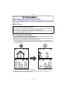
∫ Receiving signals from GPS satellites
•
It is recommended to use by holding the camera still for a while at an outdoor location
clear to the sky, with the antenna pointed upward.
• Radio waves from GPS satellites cannot be received properly at the following locations, so the
positioning may not be possible or a significant error may occur.
– Indoor/underground or underwater/in the woods/traveling in a train or a car etc./close to or
between buildings/close to high voltage lines/inside a tunnel/close to mobile phones working
on 1.5 GHz band etc.
• Do not cover the GPS antenna with your hands etc.
• Do not carry the unit inside a metallic case or similar when positioning. Positioning is not
possible when the unit is covered by metal etc.
GPS is an abbreviation of [Global Positioning System], which is a system that allows you
to check your position utilizing GPS satellites.
Calculating the current position by receiving radio waves including orbit information and
clock information from multiple GPS satellites is called positioning.
The unit can record location name information and latitude/longitude for the recorded
image and automatically correct the time.