


Using the GPS Function
104
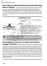
Recording Location Information and the Shooting
Date in Images
You can record and check the location information (latitude, longitude,
elevation) and the shooting date in your images and movies (pp. 45, 104). If
you use the included software (p. 2), you can also view the still images and
movies you have shot on a map, using the location information recorded while
shooting.
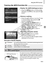
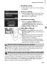
Set [GPS] to [On].
z Follow Steps 1 and 2 on p. 103 to adjust
the setting.
Shoot.
XThe location information and shooting date
will be recorded in the still image or movie.
z You can check the recorded location
information (latitude, longitude, elevation)
and the shooting date of your images in
“GPS Information Display” (p. 45).
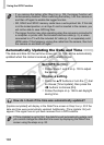
Recording the Camera’s Location Information
(Logger Function)
When the camera is turned off, it will continue to receive a signal from GPS
satellites for a certain interval of time, and record the route taken. Based on
the received signals, the location information and shooting date for a single
day will be recorded in a GPS log file, separate from images. The log files can
be used with the included software (p. 2) to view the route travelled on a map.
Since this function consumes battery power even when the camera is off, the
battery level may be lower than expected when using the camera. Charge the
battery as necessary, or keep a charged spare battery (sold separately) with
you for shooting.
• Only the location information and shooting date at the beginning of
shooting will be recorded in movies.
• For movies made in Movie Digest (p. 64), only the location information
and shooting date of the first movie of the day will be recorded.
COPY