


91
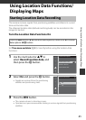
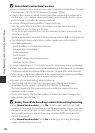
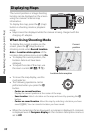
Using Location Data Functions/Displaying Maps
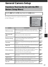
Functions That Can Be Set Using the d Button
(Location Data Options Menu)
The settings of the menu options listed below
can be configured.
• The Location data options menu can be
displayed also by pressing the d button
while the map is displayed.
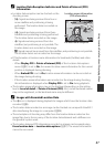
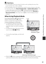
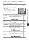
Press the d button M z (location data options) menu icon M k
button
Option Description A
Location data
options
Allows you to enable location data functions. To
update the A-GPS file, access the website below:
http://nikonimglib.com/agps3/
• Default setting:
- Record location data: Off
E79
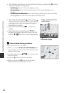
Distance units
Allows you to set the distance units of the map
display.
• Default setting: km (m)
E80
Calculate distance
Allows you to calculate the linear distance from the
current position to the shooting location of the
image or between image shooting locations.
E81
Points of interest
(POI)
Allows you to make the settings for the POI (points
of interest, location name information).
• Default setting:
- Embed POI: Off
- Display POI: Off
- Level of detail: Level 6 (detailed)
E82
Create log
Allows you to make settings for log recording of
obtained location data.
You can delete the log data or save it to memory
card.
• Default setting:
- Log interval: 15 s
- Start log: Log data for next 24 hrs
E83
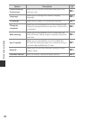
Set clock from satellite
View log
Create log
Points of interest (POI)
Calculate distance
Distance units
Location data options