100
Using the Hybrid-GPS
. User Image Mode
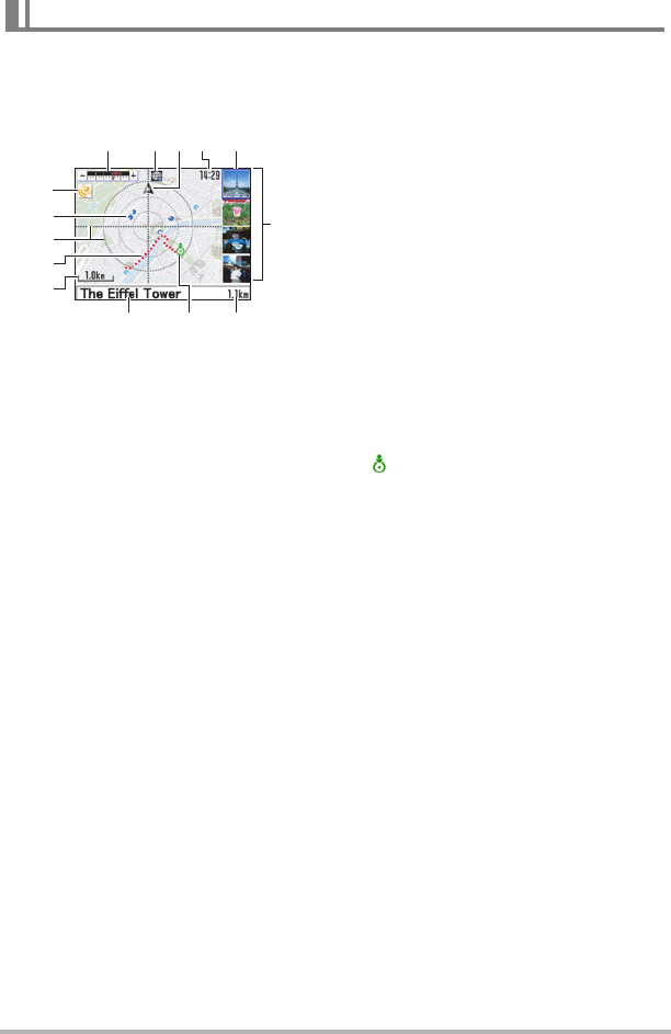
The User Image Mode screen shows images that you shot on the map screen, along
with icons and numbers that provide a wealth of information.
1
Zoom bar
Shows the current scale/position and
scale/position range of the currently
displayed map.
2
Mode icon
Indicates the current mode (REC,
PLAY, User Image, Photogenic
Spot).
3
Orientation icon
Indicates the current map orientation
(north).
4
Current time
Indicates the current time.
• The format (24-hour format or
12-hour format) of the time is in
accordance with the current
“Adjust” Setting.
5
Image cursor
The cursor is a frame around a user
image that indicates which image is
currently selected.
• The user image mark for the image
that is selected with the cursor will
flash on the map.
6
Image list
Lists the images (user images) that
were recorded on the currently
displayed map.
• The user image list shows images
in the sequence starting from the
user image mark that is closest to
the center of the radar screen, and
then radiates outwards in a
clockwise direction.
7
Distance
Indicates the straight-line distance
from the center of the radar screen to
the currently flashing user image
mark.
8
Current location icon
indicates your current location.
• The color of the figure indicates the
current GPS positioning condition
(green indicating GPS positioning,
gray for non-GPS positioning).
9
Place name
Shows the place name registered
along with a shot image (user image).
• If there is not enough space to
show the entire name, it will scroll
on the display.
bk
Scale
Shows the scale of the map.
bl
Position information log
You can display the position
information log to track your
movements over time.
bm
Radar screen lines
A cross in the center and concentric
circles radiating outwards on the map
provide references for distance and
locations.
MAP Mode Monitor Screen Content
78
12345
6
9
bo
bn
bk
bl
bm


