


104
Using the Hybrid-GPS
IMPORTANT!
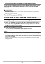
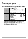
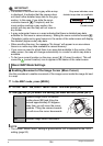
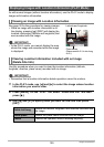
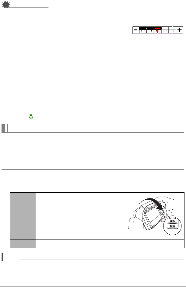
• If a section of the zoom bar is gray while a map
is displayed, it indicates that the camera does
not have further detailed map data for the gray
section. In this case, if you slide the zoom
controller towards z (Telephoto) and the
zoom pointer reaches a gray section, the
pointer will stop and the map will not zoom in
any further.
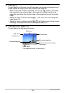
• A gray rectangular frame on a map indicates that there is detailed map data
available for that area in camera memory. Sliding the zoom controller towards z
(Telephoto) while such a gray frame is in the center of the radar screen will display
the detailed (higher scale) map data.
• When scrolling the map, the message “No Image” will appear in an area where
there is no more map data available in camera memory.
• If you move an area for which there is no map data available to the center of the
radar screen, the map will change automatically to a scale for which map data is
available.
• To find your current location on the map, press [ù] (Current Location). This will
cause the (current location) icon to appear in the center of the radar screen.
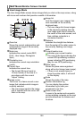
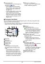
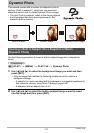
. Enabling Movement of the Image Cursor (Move Cursor)
Use this procedure to enable movement of the image cursor inside the image list next
to a map.
1. In the MAP mode, press [MENU].
2. On the “MAP” tab, select “Move Cursor” and then press [6].
3. Use [8] and [2] to select the setting you want and then press [SET].
NOTE
• The current “Move Cursor” setting is ignored while “Off” is selected for the “GPS”
setting (page 92).
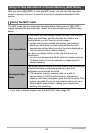
Basic MAP Mode Settings
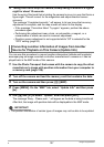
On
Enables image cursor movement.
Holding down [BS] and tilting the
camera approximately 20 degrees
away from you will move the cursor
upwards. Tilting the camera towards
you will move the cursor downwards.
Off Disables image cursor movement.
Current zoom
Gray area indicates more
detailed map data not available.
B