


60
Using the GPS
Using the GPS
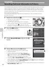
Recording Positional Information to Pictures
The Global Positioning System (GPS) is a satellite-based navigation system using the
electro-magnetic waves of a network of GPS satellites placed into orbit. It allows
users to determine their locations anywhere on Earth. The camera’s internal GPS
receives signals from the GPS satellites and calculate its current time and position.
This is known as positioning.
The positional information (latitude and longitude) can be recorded onto the
pictures to be shot.
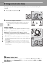
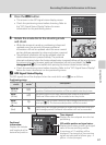
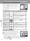
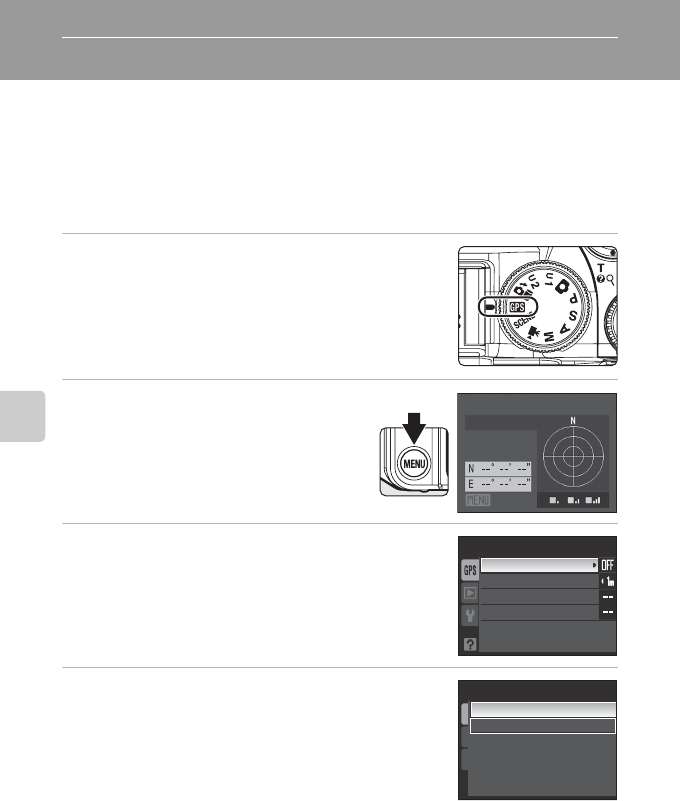
1
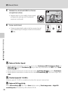
Rotate the mode dial to G.
• Operate in an open space when starting to receive
signals from GPS satellites.
• The GPS signal status display screen is displayed.
• Set the camera's date/time if it has not been set before
using the GPS function (A20, 160, 162). The GPS
function is not usable if the date/time has not been set.
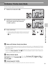
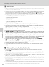
2
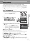
Press the d button.
• The GPS menu is displayed.
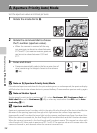
3
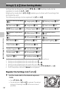
Choose Record GPS data and press the k
button.
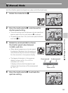
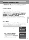
4
Choose On and press the k button.
• Signals are received from the GPS satellites and
positioning begins.
• Several minutes may be required to obtain the
positional information if setting Record GPS data to
On for the first time, or about two hours have passed
since obtaining the last positioning information.
• The setting On for Record GPS data will be recorded
even if the power is turned off, and positioning will be done every 90 minutes for six
times. However, leaving the Record GPS data setting as On will result in the battery
been depleted in a faster period of time.
• If there is a need to turn the power off when staying inside an airplane or a hospital, set
Record GPS data to Off as well.
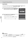
Signal strength
Position
GPS OFF
GPS menu
Record GPS data
Valid storage period
Update GPS data
Synchronize
Record GPS data
On
Off