


88
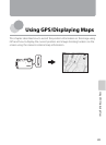
Using GPS/Displaying Maps
Displaying Maps
The current position or image shooting location can be
displayed on the screen using the camera’s internal
map information.
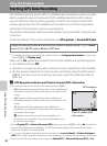
To display the map, press the action button in shooting
mode or playback mode.
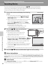
When Using Shooting Mode
To display the current position on the screen, press the
action button in shooting mode when Record GPS
data in GPS options of the map menu is set to On.
• To adjust the scale of the map, use the zoom button
(f (h)/g (i)).
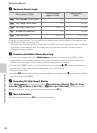
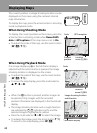
When Using Playback Mode
If an image displaying z in the full-frame display is
selected and the action button is pressed, the image
shooting location is displayed on the screen.
• To adjust the scale of the map, use the zoom button
(f (h)/g (i)).
• To move the map display, press the multi selector
H, I, J or K.
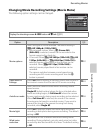
• When the k button is pressed, another image can
be selected. Only images with the recorded
position information are displayed in the thumbnail
display.
• The image shooting location and a rough direction
are indicated by
C (C indicates north), and the
selected image is highlighted in yellow.
• Press the multi selector J or K to select the image.
• To enlarge the image, press the zoom button g (i).
To return to the map display, press f (h).
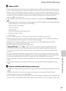
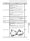
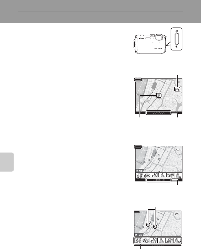
Scale
GPS reception
500km
Current
position
Location
name (A86)
Scale
Location
name (A86)
500km
Image shooting location
and direction
Thumbnail display
500km