


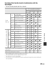
Reference Section
E113
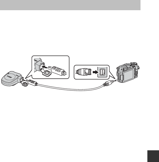
When the GPS unit (available separately) is attached to the accessory terminal,
signals from GPS satellites are received to determine the current position and
the position information (latitude and longitude) can be recorded on the
images to be shot.
Position information recorded on images can be checked on a map with
ViewNX 2 after transferring the images to a computer (A104).
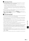
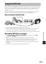
How to Attach the GPS Unit
• Turn the camera off before attaching the GPS unit.
• Make sure that the plug is inserted in the correct direction. Inserting the
plug in the wrong direction could damage the plug or connector.
• To use the built-in flash, do not attach the GPS unit to the accessory shoe.
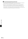
Recording GPS Data on Images
• Set Power supply of Accessory terminal in the setup menu to On
(default setting) (E95).
• Signals are received from GPS satellites and positioning starts.
• When you take an image at a place where positioning is successfully
performed, the position information is recorded on the image.
• Operate in an open-air area when starting to receive signals from GPS
satellites.
• Be aware of your surroundings when positioning.
Using the GPS Unit