Most of the information provided byyour navigation system can be seen on themap. You need to become familiar with
how the information appears on themap.
How to read the map screen
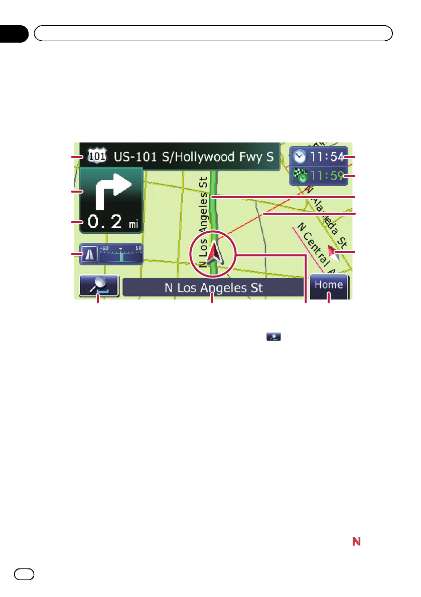
This example shows an example of a 2D map screen.
1
2
3
4
5768
9
a
b
c
d
p Information with an asterisk (*) appears
only when the route is set.
p Depending on the conditions and settings,
some items may not be displayed.
1 Name of the street to be used (or next gui-
dance point)*
Touching this item enables you to hear the
next guidance again.
2 Next direction of travel*
When you approach a guidance point, this ap-
pears in green. Touching this item enables
you to hearthe next guidance again.
3 Distance to the guidancepoint*
Shows the distance to the next guidance
point.
4 Eco-Meter
Displays a graph comparingthe past average
fuel mileage and the average fuel mileage
since the navigation system was last started.
Touching this item displays the “Eco Graph”
screen.
= For details, refer to Displaying “Eco
Graph” on page 37.
5 Map control
Touching
displays touch panel keys for
changing the map scale and the map orienta-
tion.
6 Street name (or city name) that your vehi-
cle is traveling along
= For details, refer to Setting the current
street name display on page 121.
7 Current position
Indicates the current location of your vehicle.
The apex of the triangular mark indicates your
orientation and the displaymoves automati-
cally as youdrive.
p The apex of the triangular mark is the
proper current position.
8 Home key
Touch [Home] on the mapscreen to display
the “Top Menu” screen.
= For details of the operations, refer to
Screen switching overview on page 28.
9 Map orientation indicator
! When “North up” is selected, is dis-
played.
En
32
Chapter
06
How to use the map