! When “Heading up” is selected, is
displayed.
p The red arrow indicates north.
= For details, refer to Switching the
map orientation on the next page.
a Direction line*
The direction towards yourdestination (next
waypoint, or cursor) is indicated with a
straight line.
b Current route*
The route currently set is highlighted in color
on the map.If a waypoint is set on the route,
the route after the next waypoint is high-
lighted in another color.
c Multi-Info window
Each touch of [Multi-Info window]changes
the display information.
! Distance to the destination (or dis-
tance to waypoint)*
! Estimated time of arrival at your des-
tination or waypoint*
The estimated time of arrival is an ideal
value calculated based on the value set
for “Speed” and the actual driving
speed. The estimated time of arrival is
only a reference value, and does not
guarantee arrival at that time.
! Travel time to your destination or
waypoint*
d Current time
Meaning of guidance flags
Destination
The checkered flag indicates your
destination.
Waypoint
The blue flags indicate your way-
points.
Guidance point
The next guidance point (next turn-
ing point, etc.) is shownby a yel-
low flag.
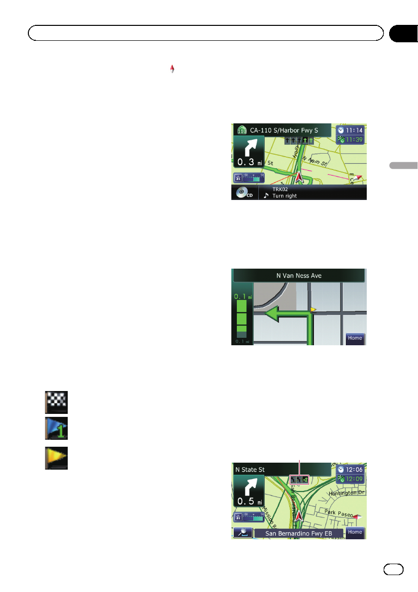
Audio information bar
If you do any operation for the audio source,
the audio information bar appears on the bot-
tom of the map screen. The bar informs you
the status of audio source.
Enlarged map of the intersection
When “Close Up View” in the “Map” screen
is “On”, an enlarged map of the intersection
appears.
= For details, refer to Setting the auto-zoom
display on page 120.
Display during freeway driving
In certain locations of the freeway, lane infor-
mation is available, indicating the recom-
mended lane to be in to easily maneuver the
next guidance.
1
En
33
Chapter
06
How to use the map
How to use the map


