


165
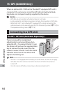
GPS (G800SE Only)
15
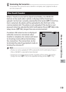
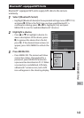
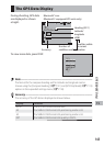
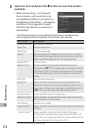
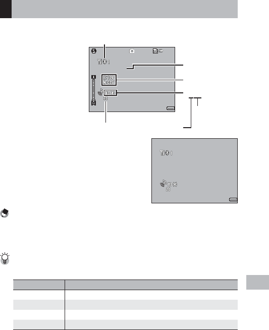
The GPS Data Display
During shooting, GPS data
are displayed as shown
at right.
359.2˚//NNW/mag
359.2˚//NNW/mag
359.2˚//NNW/mag
4:3 N
4:3 N
4:3 N9999
9999
9999
28
28
28
Bluetooth® icon
(Bluetooth®-equipped GPS units only)
Heading (GP-1)
Accuracy
×3(4)
Satellites visible
at current
location
Number of
satellites used
Latitude/
longitude
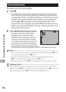
To view more data, press DISP.
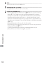
359.2˚//NNW/mag
359.2˚//NNW/mag
359.2˚//NNW/mag
E:139˚31’39.565”
E:139˚31’39.565”
E:139˚31’39.565”
N:035˚34’50.428”
N:035˚34’50.428”
N:035˚34’50.428”
Note -------------------------------------------------------------------------------------
The format for the compass heading and for latitude and longitude can be
chosen using the [Compass Heading] (GP.121) and [GPS Disp Mode] (GP.119)
options in the expanded settings menu (GP.118).
Accuracy -------------------------------------------------------------------------------
The accuracy of the GPS data is displayed as shown below:
Display Contents
no fix The GPS unit cannot receive data.
2d The NMEA-0183 format GSA positioning mode is 2d.
3d The NMEA-0183 format GSA positioning mode is 3d.
Diff The NMEA-0183 format GGA quality is DGPS.