


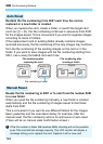
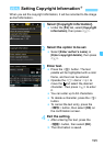
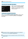

198
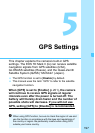
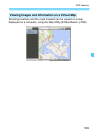
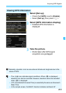
Geotag information*
1
(latitude,
longitude, elevation) and coordinated
universal time*
2
can be appended to
images.
Using the digital compass (based on
magnetic north), the shooting
direction can be appended to images.
These information can be used to
show the shooting location and
shooting direction on a map displayed
on a computer.
*1: Certain travel conditions or GPS settings may cause inaccurate geotag
information to be added to images.
*2: Coordinated Universal Time, abbreviated UTC, is essentially the same as
Greenwich Mean Time.
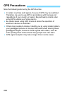
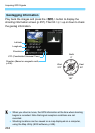
You can use the GPS logging function to automatically record the
camera’s location information at set intervals. This geotag information
can be viewed on a map displayed on a computer.
* Certain traveling conditions, locations, or GPS settings may cause inaccurate
geotag information to be added to images.
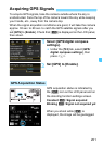
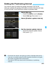
The camera time can be set using GPS signals.
GPS Features
Geotagging Images
Logging the Route Traveled
Setting the Camera Time