


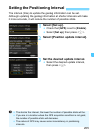


210
When using the GPS logging function,
the geotag information of the route the
camera traveled is automatically
recorded in the camera’s internal
memory.
Shooting locations and the route
traveled can be viewed on a map
displayed on a computer using the Map
Utility (EOS software, p.538).
Note that the GPS logging function will
continue to log information even when
the camera’s power is off, including
auto power off.
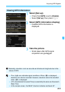
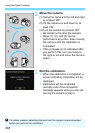
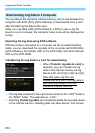
1
Select [Set up].
Check that [GPS] is set to [Enable].
Select [Set up], then press <0>.
2
Select [GPS Logger].
3
Set [Log GPS position] to
[Enable].
Select [Log GPS position], then
press <0>.
Select [Enable], then press <0>.
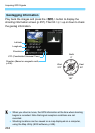
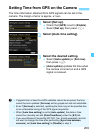
Logging the Route Traveled
Map data ©2014 ZENRIN -
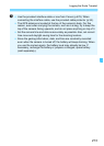
When the GPS logging function is enabled, the [ ] icon will appear on
the shooting function settings screen (p.201).
When you set the power switch to <2> or when auto power off takes
effect, < > will be displayed on the LCD panel.